The Cirque of the Towers is a ring of granite spires at the head of the North Fork of Popo Agie River in Wyoming's Wind River Range. The spires are named — Pingora, Wolf's Head, Warbonnet, Warrior, the Watch Tower, Shark's Nose — and they rise from a meadow at 10,400 feet to summits between 11,500 and 12,200 feet.
The standard loop in is from the Big Sandy trailhead, west of the cirque, over Jackass Pass at 10,790 feet, down to Lonesome Lake, and out the same way, for a round-trip of about twenty miles. The longer loop adds an exit over Texas Pass and a return through the Shadow Lake basin, for a total of twenty-eight miles.
Astrid Pereira walked the twenty-eight-mile loop, solo, on July 19, 20, and 21, 2026.
She is fifty-one and teaches navigation at a Welsh national outdoor centre, and she does not, professionally, recommend solo travel in this kind of terrain. She makes an exception in her own case the way doctors make exceptions about their own diet.
She drove from Pinedale to the Big Sandy trailhead the evening before, on the Big Sandy Road, which is washboard gravel for the last twenty-six miles and which broke a strut on her rental Subaru in a way she only discovered on the drive out three days later.
She slept in the car at the trailhead. The temperature dropped to 41 degrees overnight. She was not expecting that in July, in Wyoming, until she remembered that the trailhead itself sits at 9,100 feet.
She started walking at 6:20 a.m. on July 19. Her pack weighed thirteen kilograms with food and water. She carried a paper map of the Bridger-Teton National Forest, a compass, a satellite messenger, three liters of water, and four days of food in case of weather.
The trail to Big Sandy Lake is mostly level, through lodgepole pine. She made the lake in two hours, met three parties of overnighters coming out, and saw no one for the next four hours.
The climb to Jackass Pass is steep, loose, and exposed in its upper third. The official trail goes around the eastern side of North Lake. The unofficial shortcut goes over a boulder field on the west, saving about a quarter mile and costing about an hour. She took the official trail.
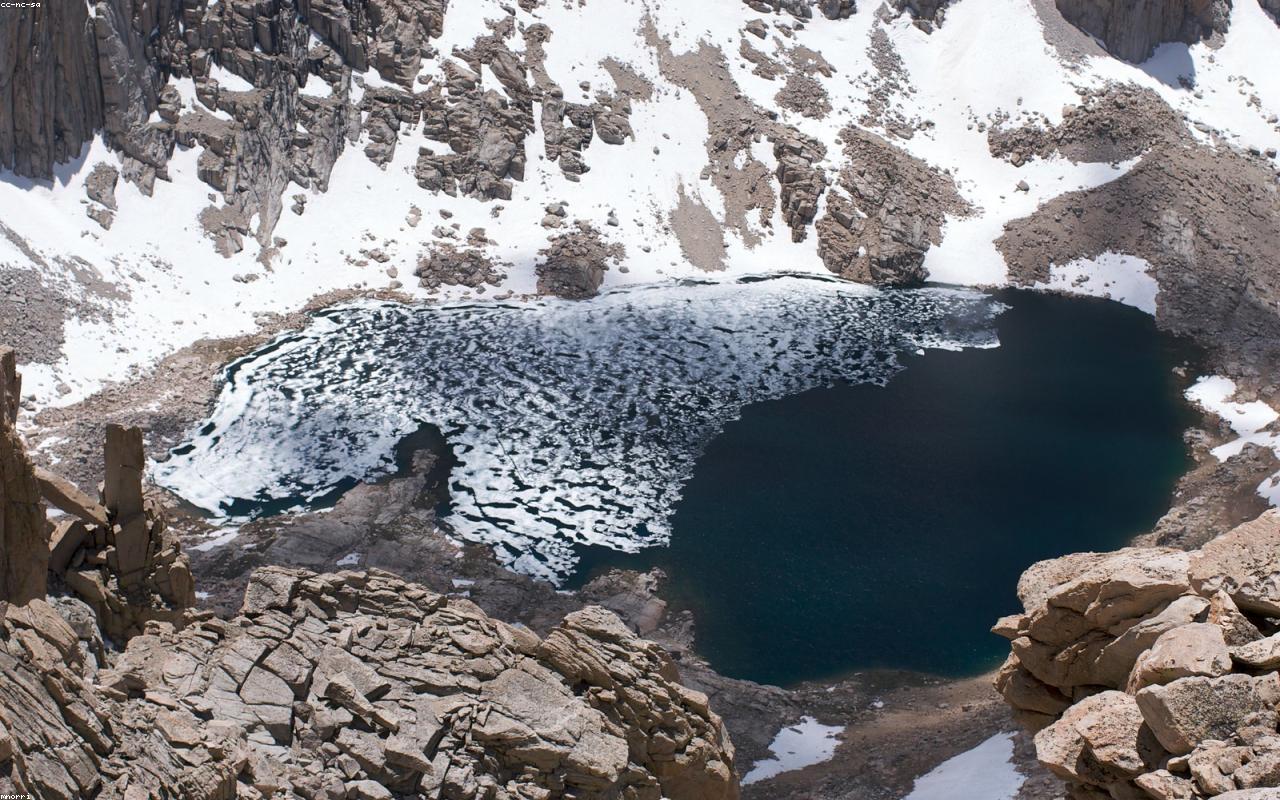
She topped out at Jackass Pass at 10:42 a.m. and the Cirque opened in front of her the way it has opened in front of every climber who has crossed that pass since the 1920s.
She sat on a rock and ate a cheese sandwich and looked at the towers. Pingora was directly across, the most photographed granite spire in the lower forty-eight, and a party of two climbers was visible on the southeast face, the size of small commas against the rock. She watched them for ten minutes through her monocular. They were moving well.
She descended to Lonesome Lake, which is misnamed — there were eleven other tents around the lake when she arrived, all of them set up at the official designated sites four hundred feet from the shore — and continued past the lake to the route up to Texas Pass.
Texas Pass is the harder pass. It rises 1,200 feet from the cirque floor in a mile and a quarter, the upper third of which is loose scree at an angle that would not be allowed as a trail anywhere in Wales without a long apologetic warning sign. There is no apologetic sign in Wyoming.
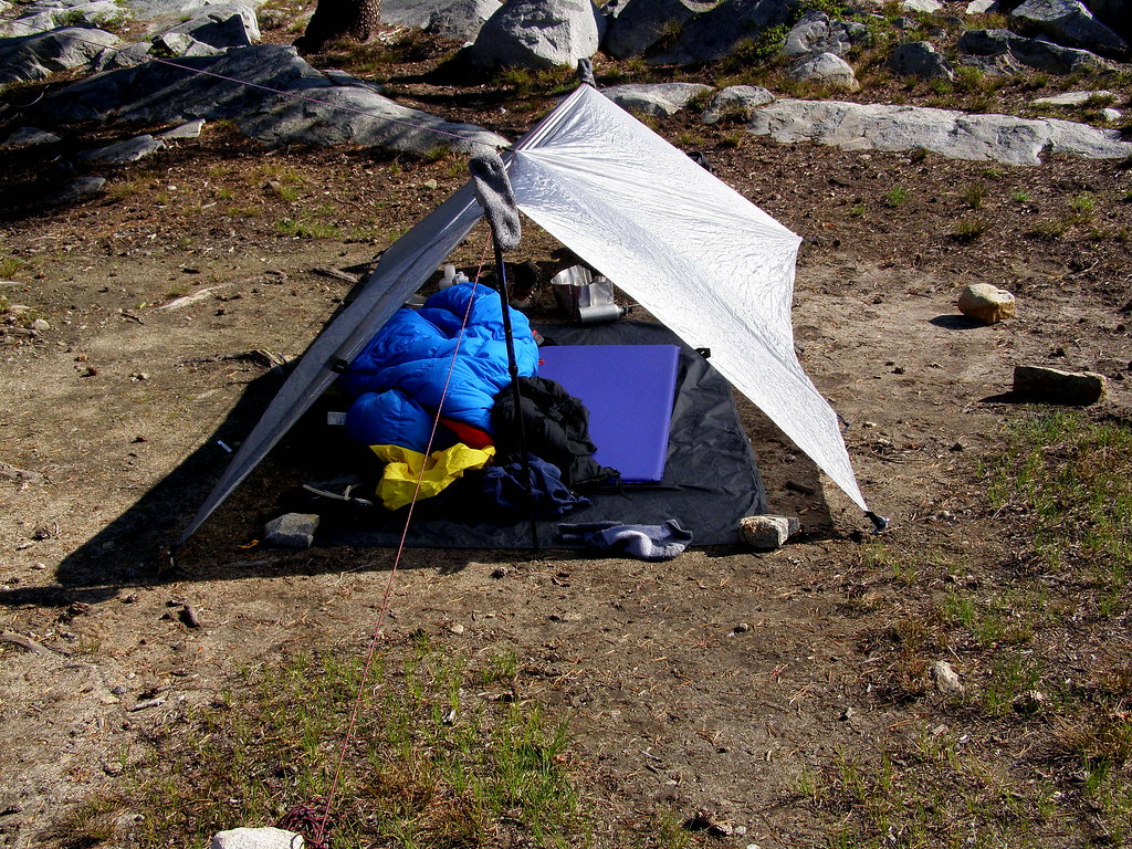
She made the pass at 3:50 p.m., descended to Texas Lake, and camped at 11,000 feet on a small flat above the inlet. The temperature dropped quickly after sunset. By 9 p.m. it was 38 degrees. By dawn on July 20 it was 31 degrees and there was frost on her tent.
She drank a cup of instant coffee and watched the alpenglow on Mount Bonneville to the northwest.
The second day she walked from Texas Lake down to Shadow Lake, around its southern shore, and along the Washakie Creek drainage. The trail through here is faint in places and crosses several boggy meadows where the line of travel is a judgment call rather than a tread.
She made one navigational error of consequence. At a confluence of two unnamed creeks below Mount Geikie, she turned right when the map and the terrain both suggested left. She walked for forty minutes in the wrong direction before the angle of the sun and the shape of the ridge behind her told her that she had gone wrong. She backtracked.
She lost ninety minutes total. She camped that night below Skull Lake, having walked about ten miles.
On the third day she walked the remaining nine miles out to the Big Sandy trailhead. The walk was uneventful. She passed eight parties going in, all of them headed for the cirque. None of them asked her about the route. She was, she observes in her notes, the only solo woman on the trail in three days, and she suspects the men assumed she was lost.
She reached the car at 2:15 p.m., discovered the broken strut on the drive out, and limped into Pinedale at 7 p.m. for a hamburger and a phone call to the rental company.
The cirque, she writes, is the equal of anything in the Alps for sheer granite drama, and it is reached, in the United States, by paying a fee of zero, with no permit and no quota and no booking system. This is unusual.
She suspects this will change within the decade. The number of tents at Lonesome Lake in July alone, she writes, makes the case for itself.