On the second Saturday in March, Howell Pratt drove forty-one miles from his house in Lincoln, New Hampshire, to a turnout on the Kancamagus Highway and parked under a sky the colour of pewter. He took out a printed copy of the Mount Osceola 7.5-minute quadrangle, a red Pilot G-2 pen, and a small notebook bound in waxed canvas. He walked for six hours.
Pratt is sixty-eight. He retired in 2019 from a career as a high school earth-sciences teacher. Since 2021 he has been one of the volunteer stewards in a quiet program inside the U.S. Geological Survey that keeps the 7.5-minute topographic series honest. The program has no formal name. Inside the National Geospatial Program it is referred to as the volunteer field-check pool. As of February 2026 it has about four hundred active participants.
The 7.5-minute series, also called the quad series, was the standard American topographic map for most of the twentieth century. Each sheet covers a rectangle of 7.5 minutes of longitude by 7.5 minutes of latitude, about fifty-six square miles at mid-latitudes. The original surveys, done with plane tables and alidades, took the better part of seventy years to complete. The last of the original quads was published in 1992.
What Pratt and his colleagues do is not surveying. They are checking. The USGS still produces the quads, but since 2009 most have been generated from a database called The National Map, which pulls automatically from federal, state, and local sources. The trouble is that the database does not always know when a logging road has been gated, a footbridge has rotted out, or a beaver pond has reclaimed a half-mile of trail.
It also does not know when a place name has changed. The town of Lincoln, in 2021, voted to rename a small body of water from Squaw Lake to Pemigewasset Pond. The 2024 edition of the Mount Osceola quad still carried the old name. Pratt noticed it on a walk in October of that year. He wrote it down. He sent the correction in. The 2026 edition of the quad has the new name.
The corrections route through a small office in Rolla, Missouri, which is the headquarters of the USGS's Mid-Continent Geospatial Science Center. A cartographer named Anita Reyes processes most of the New England submissions. She has held the position for eleven years. She estimates that the volunteer pool sends in roughly nine hundred discrete corrections each year.
About sixty percent of those, Reyes said in a phone call in early April, are trail or road changes. About twenty percent are hydrology, mostly small streams that have been rerouted or impoundments that have been built or drained. The remaining twenty percent are a grab bag: structures that no longer exist, structures that have been built, place-name updates, contour anomalies, and the occasional missing peak.
There is no payment. Volunteers receive an annual letter on USGS letterhead, a printed certificate, and access to a low-priority cartographer's email account if they have questions. Pratt keeps his certificates in a manila folder in the second drawer of his desk. He has five of them.
The selection process for stewards is informal. Most are retired teachers, former Forest Service or Park Service employees, or amateur cartographers who reached out to the agency themselves. A handful are working professionals — a Maine land surveyor, a Wyoming wildlife biologist, an engineer in Tacoma who covers four quads in the southern Cascades. The youngest active steward as of February is thirty-one. The oldest is eighty-four.
What unites them, Reyes said, is a tolerance for unglamorous work. A field-check walk produces a marked-up paper map and a list of coordinates, not photographs or stories. The corrections, once submitted, appear on the next edition of the quad with no attribution. Pratt has never been named in a USGS publication. He does not expect to be.
The program persists for two reasons. The first is that the National Map's automatic ingestion of state and federal data has gaps, particularly in the matter of trails. The U.S. Forest Service does not maintain a comprehensive national trail database. State data is uneven. Volunteer field-checks fill in what nobody else is paid to look at.
The second reason is that the 7.5-minute series, despite being available free as a digital download, is still the base map for a great deal of practical work. Search-and-rescue teams use it. Wildland firefighters use it. The Appalachian Mountain Club's trail crews use it. So do trial lawyers in property disputes, and so does the Federal Emergency Management Agency when it draws flood maps. A quad that is wrong about where a stream runs is a small but real problem.
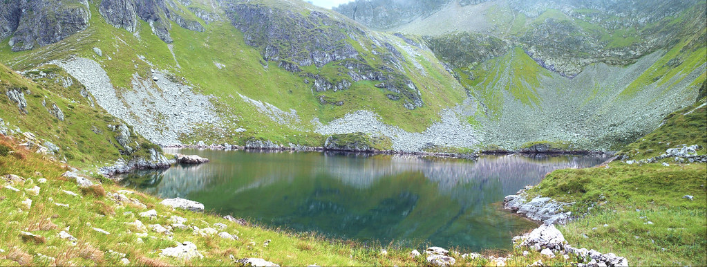
Pratt's quad, Mount Osceola, covers a piece of the White Mountain National Forest that is heavily walked in summer and almost empty in March. On the morning of his March visit he started up the Greeley Ponds Trail, turned east onto an unnamed Forest Service road, and worked a loop of about nine miles. He checked four trail junctions, two stream crossings, and one beaver complex that had grown by perhaps two acres since the previous year's edition.
He also corrected an elevation marker. A small spot height on the southern flank of Mount Kancamagus reads 3,728 feet on the 2024 quad. Pratt suspects it should be 3,748. He photographed the actual benchmark, took a GPS reading, and noted the discrepancy. Reyes will look into it. Benchmark corrections require more documentation than trail changes, because they involve the geodetic record, not just the cartography.
The volunteer program operates on a budget of, by Reyes's estimate, less than twelve thousand dollars a year. Most of that is postage. The USGS mails printed quads to stewards who request them, at no charge, and pays for the return postage on submissions. Some stewards prefer to work entirely electronically, marking up PDFs and emailing them in. Pratt prefers paper. He likes the way a folded quad feels in a jacket pocket.
Asked why he does it, Pratt was unfussy. He likes to walk. He has walked most of the trails in his quad many times, and he notices when something changes. Sending the changes in feels, he said, like keeping a small piece of public infrastructure in working order. He does not think of it as conservation work, exactly. He thinks of it as keeping a book accurate.
There are larger questions about the future of the program. The National Geospatial Program has not made a long-term commitment to the volunteer pool, and Reyes is the only full-time cartographer assigned to processing volunteer submissions in her region. She is sixty-three and has begun to think about retirement. The agency has not announced a replacement, or a plan for the program after she leaves.
When asked, an USGS spokesperson in Reston, Virginia, said that the volunteer field-check program is currently under review as part of a broader assessment of the agency's topographic mapping workflows. She declined to elaborate. Reyes, for her part, has begun training a younger cartographer in Rolla on the volunteer intake process, on her own initiative, without a formal mandate.
Pratt does not follow the agency politics. He has signed up for another year. In May he will walk a section of the quad he has not visited since 2022 — a small bog complex on the north side of Loon Mountain, where a beaver dam failed in the spring of 2023 and the hydrology has been changing ever since.
The next edition of the Mount Osceola quad is scheduled for 2027. By the time it is published, Pratt will be seventy. He intends to be walking the quad still.