The route was first sketched on the back of a serviette in the bar of the Cairngorm Hotel in Aviemore in November 2025. Its author was a retired civil engineer named Donald Reith, who had spent forty years walking the Cairngorm plateau and had decided that the established traverses missed a quieter line.
Reith's proposal was thirty-one kilometres from the Coire Cas car park, over Cairn Gorm and Ben Macdui, then west by an unmarked spur to Carn a' Mhaim, then south along a long descent to Linn of Dee. Most of the distance is above eleven hundred metres. There is no shelter for the whole middle third.
Reith circulated the route to the Boat of Garten Walking Club in December. By March the club had eleven members willing to attempt it as a one-day spring traverse. The first walk was set for the last Saturday in April.
The Cairngorm plateau is the largest area of land above nine hundred metres in the British Isles. It is older than the Alps by a significant margin. It is also famously unforgiving in poor visibility, a fact the club's safety officer, a woman named Fiona MacGregor, mentioned at the briefing in tones that suggested she had said this many times before.
Two of the eleven, MacGregor herself and a younger member named Calum Watt, walked an advance reconnaissance on April 23. The weather had been dry for a week. A high-pressure system was sitting over the central Highlands and was forecast to hold through the weekend. The conditions were as benign as the plateau ever offers.
They started at 0530 from the Coire Cas car park. The funicular was not running. They were on the summit of Cairn Gorm by 0720, in a wind that MacGregor estimated at thirty knots, cold enough that they put on shell layers despite the climb.
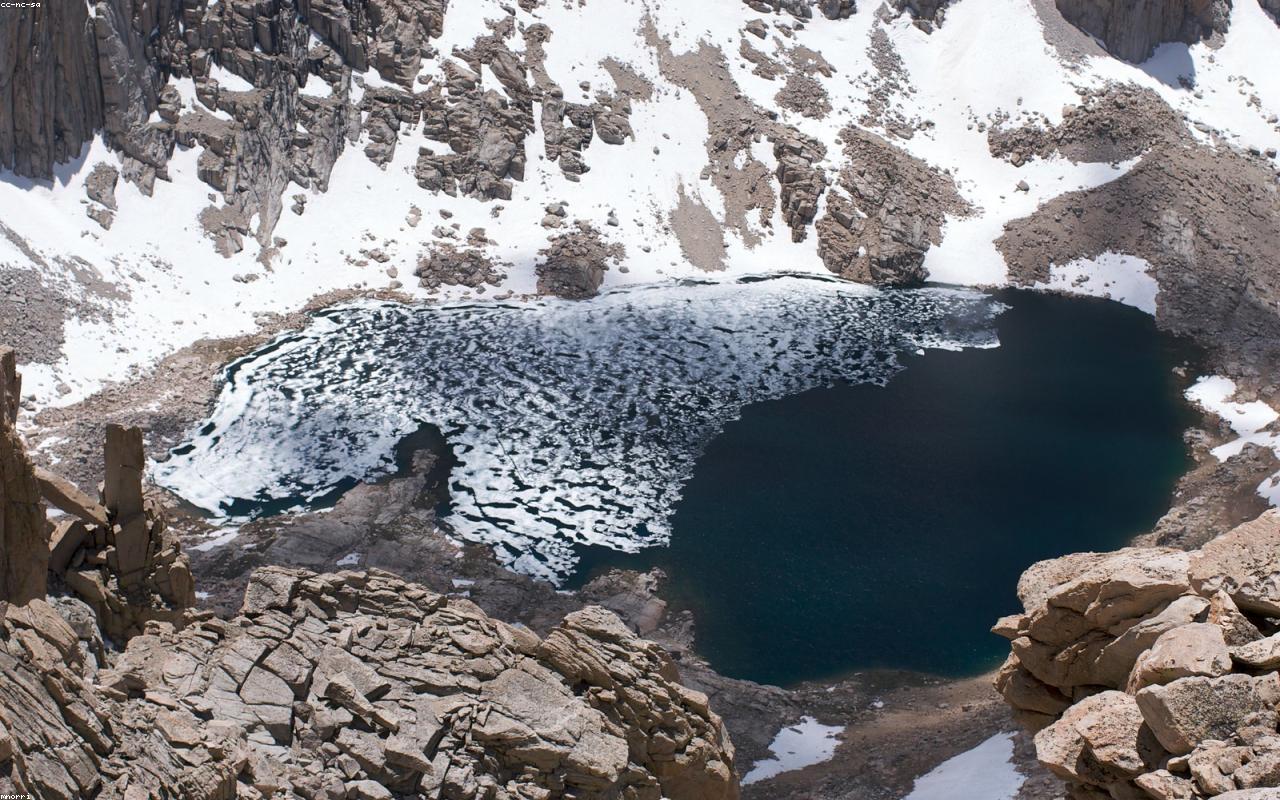
The traverse from Cairn Gorm to Ben Macdui crosses the high plateau by a route that has no path. There are cairns at intervals but they are not reliable. The ground is granite gravel and small lichen, with occasional patches of late snow lying in the lee of boulders.
MacGregor navigated by compass and by pacing. She does not carry a GPS as a primary instrument, although she carries one in her pack. She has taught navigation for the Glenmore Lodge mountain training centre for twenty-two years and considers the GPS a check rather than a tool.
They reached Ben Macdui at 0945. The summit cairn was empty. The view extended, in the clear morning, from Ben Nevis in the west to the North Sea in the east. MacGregor said later that she had seen the view perhaps a dozen times in thirty years of walking the mountain.
The new section of Reith's route began at Macdui. The standard onward line goes south to the Tailors' Stone and the Lairig Ghru. Reith's line goes west, by an unmarked broad shoulder, to drop into a small pass at about a thousand metres and then climb to Carn a' Mhaim.
It is on this section that MacGregor and Watt made their first significant note for the club. The descent from Macdui to the pass is loose granite scree for about two hundred metres of vertical, and in wet weather it would be slow and unpleasant. They marked it as a section to be reconsidered.
Carn a' Mhaim sits as a quiet outlier at the southern end of the high massif. It is rarely climbed. Its summit is a long ridge with no cairn until the western end. MacGregor and Watt arrived at 1240. They ate a long lunch on the lee side of the summit rocks, out of the wind, looking south to the Linn of Dee and the Glen Lui woods.
The descent took five hours. The route Reith had drawn followed a long shoulder south-east, then dropped into the Lui Water and followed the path west to Linn of Dee. The shoulder was easy walking. The path along the Lui was wet underfoot in several places and MacGregor noted that in late autumn it would be slow.
They reached the Linn of Dee car park at 1740. The full route had taken twelve hours and ten minutes. They had walked thirty-two kilometres and climbed approximately fifteen hundred metres. MacGregor said it had been one of the longest single days she had done on the plateau in five years.
The reconnaissance produced a list of seventeen notes which MacGregor circulated to the club. Three of the notes concerned navigation. Six concerned ground conditions. Two concerned the absence of any reliable water source between Macdui and the Lui Water. The remaining notes concerned timing and bail-out options.
The full club walk, on April 26, attempted the route with nine members. They were turned back at Ben Macdui by deteriorating visibility. The cloud came down to nine hundred metres by 1000 and the group made the decision to descend by the standard tourist path to Coire Cas. They were off the mountain by 1330.
MacGregor said later that the decision to turn back had been straightforward. She estimated that in the conditions, the unmarked section between Macdui and Carn a' Mhaim would have taken twice as long and required constant compass work for the lead navigator. She did not think any member was incapable of the navigation. She thought the cumulative fatigue would have been the problem.
The club intends to attempt the full route again in June, when the days are longest and the high snow patches have melted. Reith himself, who is seventy-eight, plans to walk it with them. He has said that he would prefer to walk it in good weather but that he will walk it in poor weather if that is what the day offers.
Filed under